

The Goldfields Track is a 210km network of trails that runs from Buninyong, south of Ballarat to Bendigo through the gold mining towns of Central Victoria. The trail can be covered by bike or on foot, in one large thru-hike or in small sections or day walks. It combines the Eureka, Wallaby, Dry Diggings and Leanganook Tracks to take you through varying landscapes on walking tracks, fire access roads and single track forest trails past the remnants of the historical era that formed Victoria.
I’m undertaking this track in two pieces, the first of which I completed last week with my brother.
Day 1 Outskirts of Ballarat to Slaty Creek Campground No.1 (We started on the outskirts because we are forest kind of people and chose to skip the city trails.)
Distance covered: 15.40km
Time taken (excluding meal breaks): 3hr 44m

Day 2 Slaty Creek Campground No.1 to Mullens Dam
Distance covered: Official on watch 25.12km plus estimated 4km when I forgot to turn watch back on after lunch. Est. total: 29km
Time taken (excluding meal breaks and 4km pause on watch): 5hr 48m

Day 3 Mullens Dam to Daylesford
Distance covered: 22.51km
Time taken (excluding meal breaks): 5hr 10m

Day 4 Daylesford to the Chocolate Mill
Distance covered: 20.00km
Time taken (excluding meal breaks): 4hr 49m

Trails
The Goldfields Track is very well marked so it is not particularly necessary to take a map but there are some points where cyclists take a different route to walkers and while the signs will indicate this, we found it useful to have the map to check. We also changed our route a bit so a map was useful to find our way. You can get an excellent guide book with maps and points of interest from here.

For walkers, most of the trails are on bush tracks, usually single track so if you are someone who needs to converse to another person beside you, this may not be the hike for you. There are wider sections on fire trails and access roads. There’s also a rather horrendous (at least it was for us) 10km stretch of gravel and then bitumen road before Mollongghip. Thank goodness we had already decided to skip the township and cut through to Six Mile Siding on the way to Mullens Dam via Dredge Track in the Wombat State Forest. You could visibly see us relax the minute we stepped back under the tree canopy onto a dirt track.
Do be careful, though. The paths can be quite rocky and gravelly and it is easy to slip or trip. I almost headbutted a marker post when my foot slipped and I lost my balance. Fortunately I missed the post and landed on my backpack. No harm done. I recommend a hiking pole. (I had one but in this case it didn’t save me. It did a number of other times though so highly recommend at least one.)

Most trails are marked on the Goldfields Track maps so if you want to change your route and take some different trails it’s not too hard to do.
There are also several extra side trips you can make if you so wish such as a loop into the town of Creswick, a trip to Sailor’s Falls or to explore the Three Lost Children Walk.

History
The most exciting aspect of this walk is literally walking through history. The remnants of the gold rush of the 1850s are everywhere. Shafts, mullock heaps, water races, building ruins and old tram and train lines scatter the landscape. Sometimes you have to shake yourself to remember that these remains are from people who lived, worked and dreamed of finding gold here more than 150 years ago.


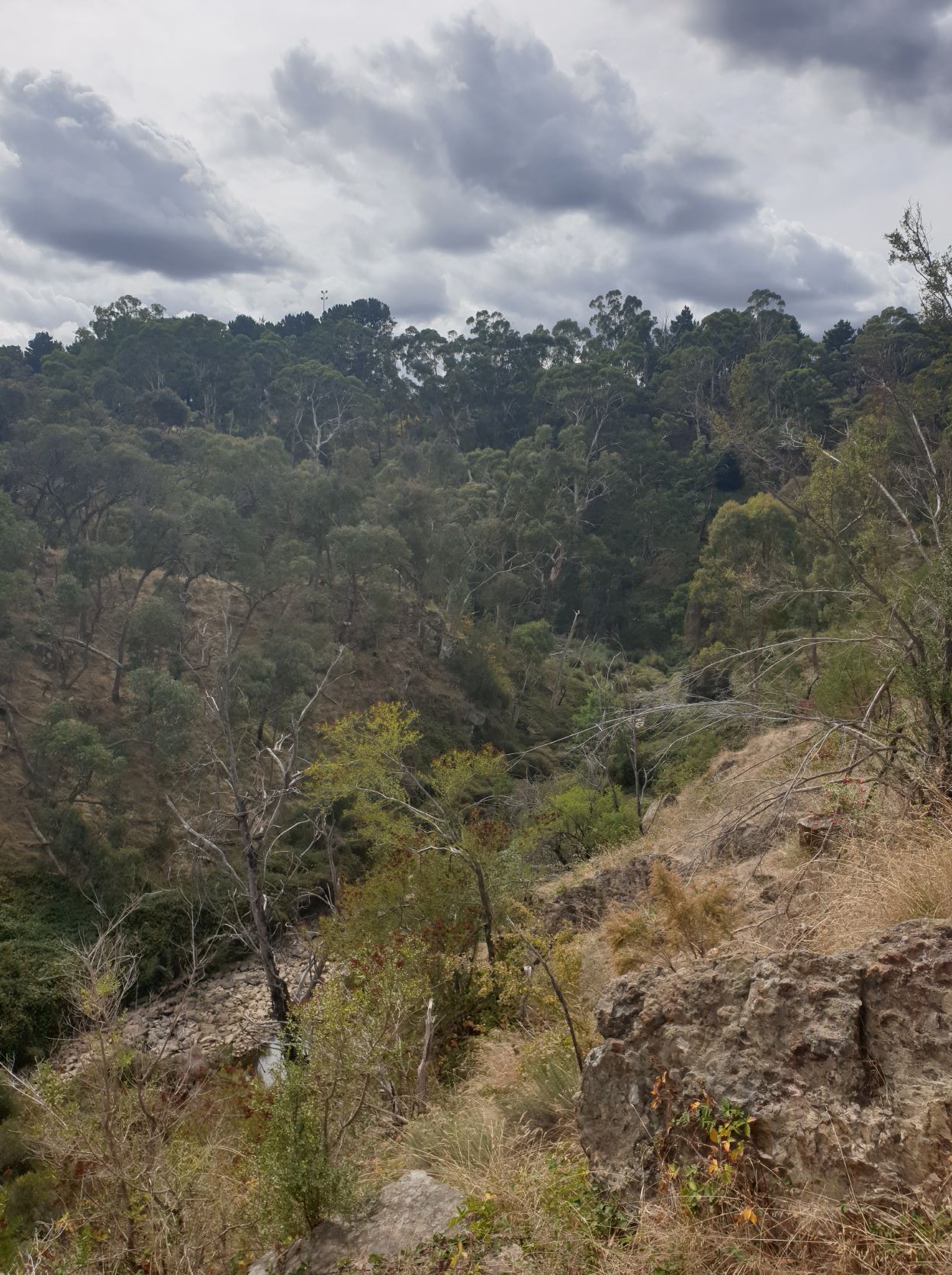
Nature
You’ll rarely be bored on this walk as you journey through changing environments from the wet temperate forests near Daylesford to dry plains near Castlemaine, from deep creek gullies to wheezing hills, through towns built on the wealth of gold, past pine plantations and paddocks of sheep and cows. Animals and birds will also be in aplenty if you’re quick enough to spot them. I found talking to the cows a good way to take my mind off a tedious hilly road and who could ever tire of birdsong in the forest?


Sleeping
There are a number of campsites along the route and ‘wild’ camping is permitted in the Wombat State Forest under certain conditions. Check with Parks Victoria. (Pro tip: There are three campsites at Slaty Creek. Try and stay at No 1; it’s the only one with toilets.) We stayed at the holiday park in Daylesford and I have to admit I have never been so grateful for a flushing toilet, drinking water, soap and a hot shower.
Be aware that none of the Slaty Creek campsites have tank water and even creek water can be scarce. The creek was mostly dry when we were there. We managed to find a reasonable-sized pool about 150m up the creek bed to source water. (It had tiny fish in it so we thought it couldn’t be too bad.) All water will need to be filtered or treated. You can get mineral water via pumps at various points near Daylesford and Hepburn Springs. These are tested regularly so if the pump is operating it should be safe to drink. (I did.)
If camping is not your thing, the track goes through or near a number of towns that provide various accommodation options. There’s glamping tents at the Daylesford Holiday Park if you want the luxury camping option.
A Story
At one stage on the walk, we started to hear what sounded like someone operating a drill in short bursts. It went on for quite a while. “You’re killing the serenity!” I called out. My brother was sure we were about to come across someone riveting a million bolts into a new creek bridge. I found this a bit odd because I would have sworn the sound was behind us but it’s always hard to tell in the bush. When we stopped for lunch, the sound had mercifully ceased. Until I pulled my pack over to grab my lunch out of the top. The sound started up again. Inside my pack. It was my little rechargeable air pump. Something had obviously been banging against the on-off button, turning it on and off. So when my brother thought it was ahead of us, it was only because I was walking in front of him. We’d been walking for a good half hour, annoyed at a non-existent tradesperson when all along it was me.
Quiz
Can you see the animal in this photo?

Next
We are planning to complete the rest of the Goldfields Track in another trip sometime this year but in the meantime, I’ll be heading off solo along the Great Ocean Walk on April 18th. I’m feeling ready.
Does the Goldfields Track sound like somewhere you’d like to explore?

Slaty Creek campground no 1 featured heavily in our years in Ballarat, in fact we are planning on taking the kids there over Easter….for a stroll rather than a hike….
Glad you enjoyed your hike, it’s a beautiful place…
LikeLiked by 1 person
It was a lovely place to spend the night. Apart from needing my earplugs because the frogs in the creek were partying all night.
LikeLiked by 1 person
What an excellent adventure!
I can relate to the air pump. I had a rechargeable toothbrush that turned itself on in a hotel room in the middle of the night. Not a real loud sound, but annoying enough. When I finally found that it was the toothbrush, I couldn’t turn it off. I guess it was preparing to die, and was uttering it’s last words… It buzzed for another half day as we drove to our next destination.
LikeLike
Mosy ! – this is SERIOUS bushwalking ! And with your brother ! – who knew ? 😀
Such joy it’s bringing you. I’m so happy that it’s making you happy.
Oh the nearness of history; I hadn’t known that there’d been gold-mining in that area – I don’t mean Ballarat, of course, but what seems so much further south ..
As for your apostrophising the nearby noise-maker .. words fail. [grin]
LikeLiked by 1 person
Oh, M-R, it was fabulous. We have been planning to do this track for a while and were supposed to do the first leg in May but I decided to finish the term early and called him up to see if he wanted to go and he made it happen. And I’m so glad he did because I feel so much more confident in tackling the GOW next week. Can’t wait to do the next leg together as soon as we can find a mutual weekend (plus some days either side!).
LikeLiked by 1 person
I prefer you bushwalking to running: you won’t be (I bloody HOPE) all skinny and muscly ! Muscley ?
LikeLiked by 1 person
Well, I can’t guarantee that. I’ll let you know what happens after next week’s walk. 😁
LikeLiked by 1 person
Gosh, you and Mel put me to shame! Such serious hikers and campers! I do enjoy following you on your trails though, all the interest and none of the hardship. I look forward to seeing how you get on with the GOW after reading Mel’s first couple of days.
LikeLiked by 1 person
Mel’s posts have been very useful. I’m taking 7 days to do the GOW so I only have one long day in the middle. After this last hike I wondered if I should have booked for fewer days but then decided I’d quite like the leisurely pace. 😀 Being school holidays, it will also mean I should get a decent camp spot as I’ll get into camp reasonably early. I can’t wait!
LikeLiked by 1 person
Leisurely is good, it would be a pity to rush past those wonderful views along that route.
LikeLiked by 1 person
I watched a video of someone doing it in four days. It made me wonder what the point was other than to get from point A to point B as fast as possible which to me kind of misses the whole purpose of the walk.
LikeLike
That sounds like a wonderful hiking/camping mission. I’m glad it worked out so well and I really like the idea of marking the trails for bike and hiking use where they can be different.
LikeLiked by 1 person
It was a fantastic trip and I learned some more useful tips for my trip next week so I’m glad we got to do it last week. After we finish hiking the track, my brother intends to do it again by bike. The maps are also colour coded for the trail with shared trails marked in yellow, walkers only in orange and bikes only in brown. The book has been put together by volunteers so it’s been a mammoth effort.
LikeLiked by 1 person
We owe so much to those volunteers.
LikeLiked by 1 person
Laughed out loud at your trail story 🤣
It was a big trip and a lot of ground covered each day. Well done! So glad it went smoothly and you had a good time. I love the photo of the stone ‘bridge’ … my kind of water crossing 🙂
LikeLiked by 1 person
It was so embarrassing!! But it gave us a good laugh and me a good lesson. 🙂
We would roll into camp, flake out on the ground, groan when we got up, but then in the morning we were raring to go for the next leg. I found it reassuring that I can cover those distances if I need to and not collapse entirely.
LikeLiked by 1 person
Gosh glad that you fell on the backpack and not some bodily part! Hiking poles or even a solid (non-pointy) stick is a great suggestion. I was surprised at the levels of erosions in certain spots as a result of after effects of old mining. A Chocolate Mill? That is tempting.
LikeLiked by 1 person
As my friend said “You turtled!” 😄 Getting up was interesting but I managed it without help.
Yes, it’s a fascinating walk as you can so easily imagine it teeming with miners each beavering away on their own small claim hoping to strike it rich. They’ve certainly had a lasting impact on the environment.
I very much enjoyed my dark chili hot chocolate at the end. 😁
LikeLike
🤎🤎🤎
LikeLiked by 1 person
I’ve never heard of the goldfields track but it looks like a great hike with a mix of bush land and history. Greetings from Perth.
LikeLiked by 1 person
Hi!! [waves madly in a westerly direction]
It’s such an interesting trail. Always something new to see or experience. I’m looking forward to seeing what the second half will bring.
You’ve got some great hikes over your way. I know the Bibbulmun is very popular but I’m keen to do the Cape to Cape because, well, wine.
LikeLike
I have done bits of the cape to cape but would love to do it all in one hit one day! It is stunning scenery for sure!
LikeLiked by 1 person
Mr ET was born and grew up in Ballarat so we’ve visited many times over the years. The area around there is so pretty and the history is fascinating. If we go there when it’s freezing cold, which is often, I always think of those miners camping out in calico tents. They must have been hardy souls. Well done on completing this walk. It sounds like an adventure.
LikeLiked by 1 person
It’s a great area. Yes, I imagine luxuries were few. And boy does it get cold at night in winter!
I have family in both Ballarat and Castlemaine so this was a good first multi-day hike to do knowing there was back up not too far away if we needed it. 🙂
LikeLiked by 1 person
It can get cold at any time of year. Mr ET’s father passed away one January and it sleeted at the cemetery the day of his funeral.
LikeLiked by 1 person
Classic story about the air pump! You gotta laugh! 🙂 It looks like a fabulous walk and I love that feeling of walking through history. Ta
LikeLiked by 1 person
It certainly gave us a laugh! It’s such an interesting walk. Highly recommend. 😁
LikeLiked by 1 person
We had a same, same but different experience in France…what is that horrid smell wherever we walked? It was some true French cheese in the husband’s backpack!
LikeLiked by 1 person
😂
LikeLiked by 1 person
The Goldfields Track looks wonderful to me. I’d stay in a B&B along the way, not being one for camping. I did get a good laugh about your mistake about who was making the noise. Oops!
LikeLiked by 1 person
Being in an area built during the gold rush there are some lovely historical places to stay.
I still can’t believe we walked for so long without figuring out the sound was coming from my backpack! 🤔
LikeLiked by 1 person